GeoSNAP-Dolphin Integrated Navigation System
无标题文档
|
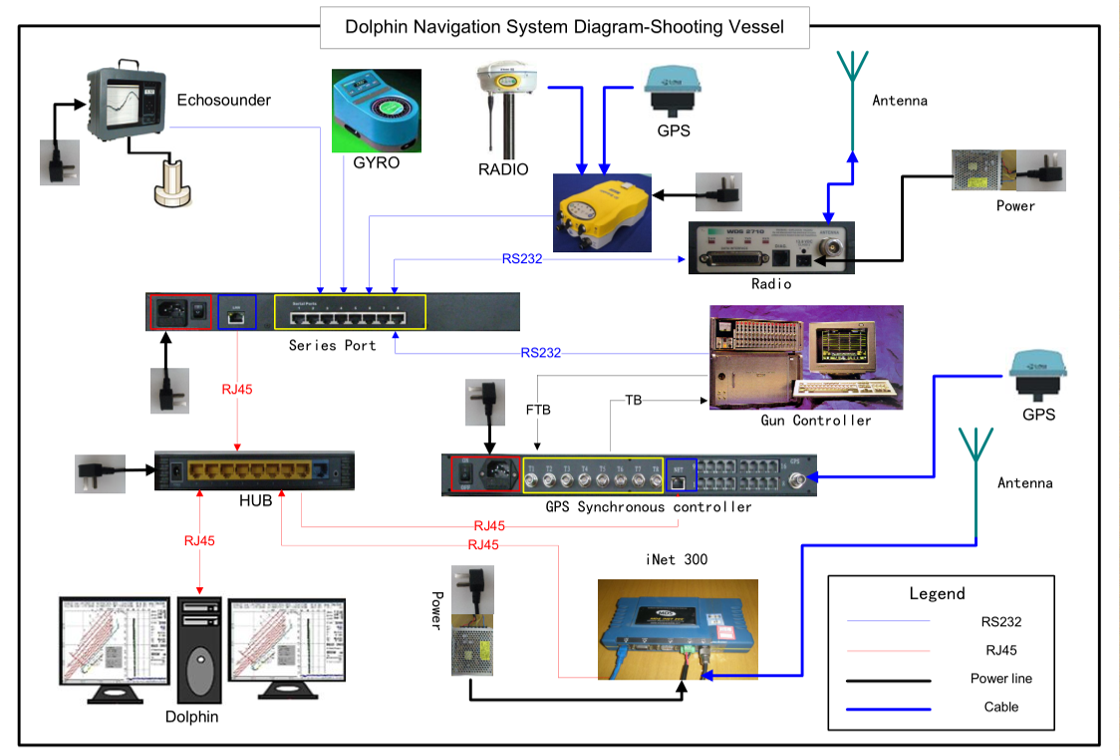
GeoSNAP-Dolphin is a Windows based integrated navigation and data management system designed specifically to meet the demands of multi-vessel distributed operations such as ocean bottom cable/node, transition zone and reservoir monitoring. Dolphin delivers a unique combination of centralization, data management, advanced positioning techniques, and flexible configuration. The system not only improves the acquisition quality and the production management, but also reduces the cost of operation.
|
| Key Feature: |
|
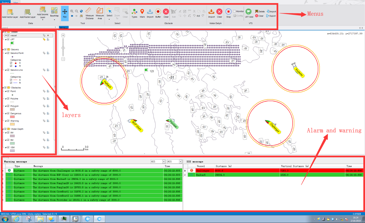
● Multi-vessel navigation and management
● Flexible system design
● ISS shoot mode
● Flip-flop shoot
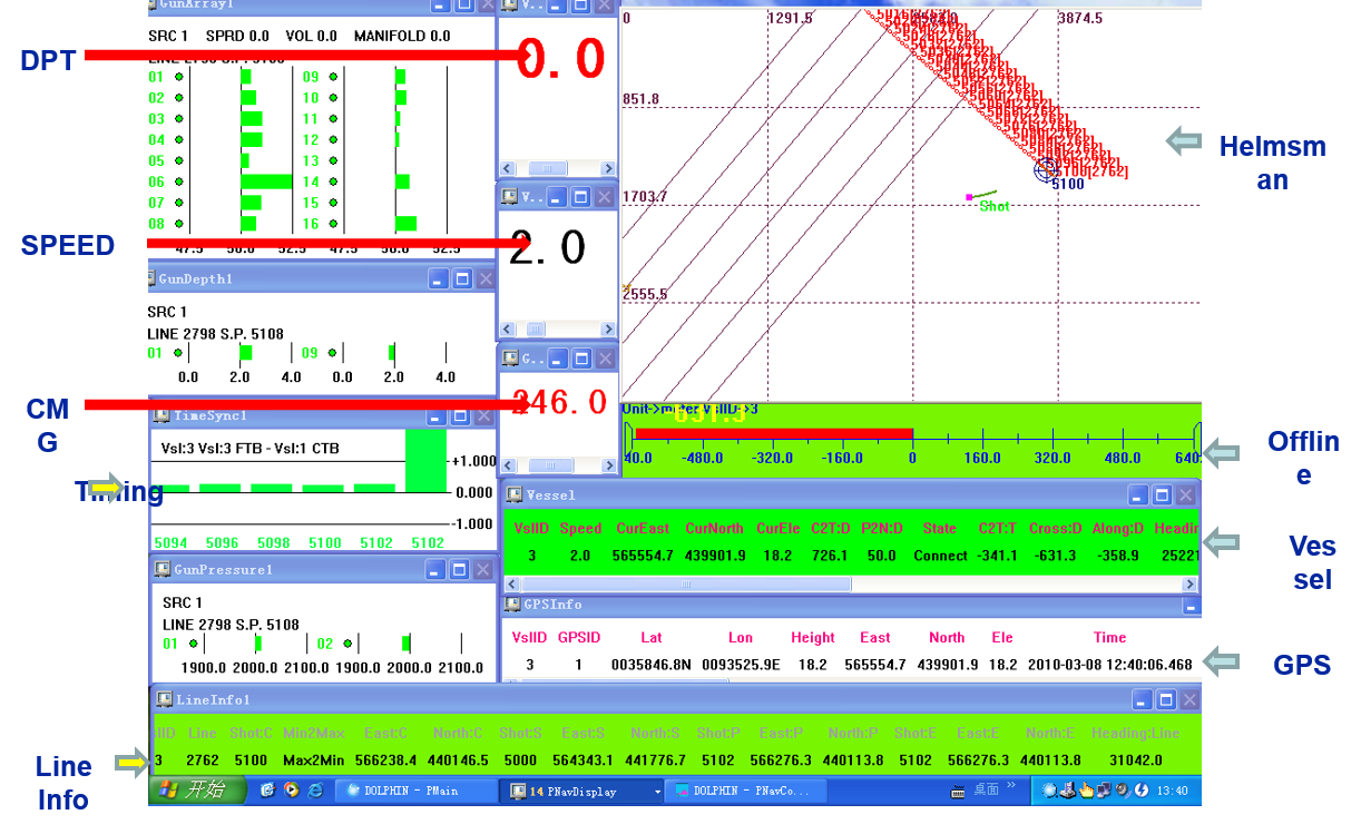
● Remote positioning result monitoring
● Real-time QC
|
| |
- Centralize/Remote Control
- Synchronization Control
- Vessel Monitoring
- Data Recording in Standard Format
- HSE Management
|
|
● End-of-line report
|
|
|
| |
|
| |