Service & products
|
|
|
|
|
| |
| |
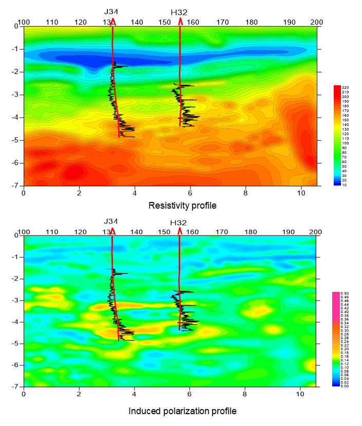
Time-frequency Domain Electromagnetic Surveys
TFEM® method is a new controlled source EM technique. For this method, EM fields could be acquired by observation in both frequency and time domain simultaneously, then resistivity(R) and induced polarization(IP) anomalies could be derived to study the geoelectric structures and predict favorable areas.
|
|
| |
|
|
| |
 |
|
| |
|
|
| |
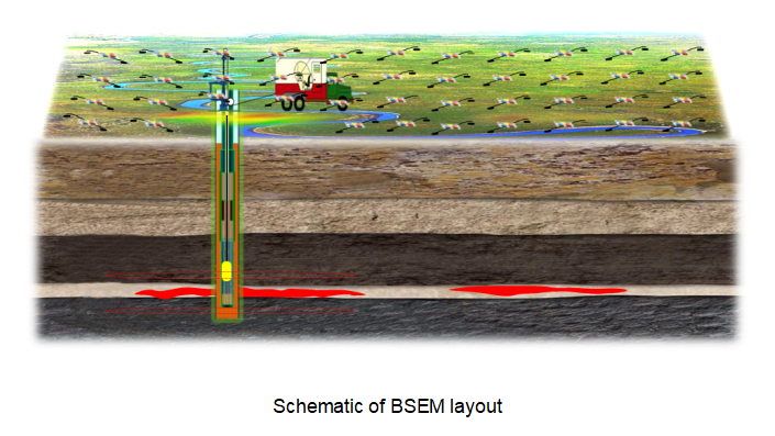
Borehole-to-surface Electromagnetic Surveys
BSEM is a high-accuracy electromagnetic prospecting method that uses AC-powered vertical finite line source (one electrode on the surface and another one in the borehole) as the excitation source. When the electrode in the borehole is powered above and under the studied reservoir, respectively, and two times of electromagnetic response are recorded on ground. The boundary of target hydrocarbon-bearing layers and oil-bearing features of adjacent trap could be mapped based on the anomalies of resistivity and polarization derived from the electromagnetic responses.
|
|
| |
|
|
| |
 |
|
| |
|
|
| |
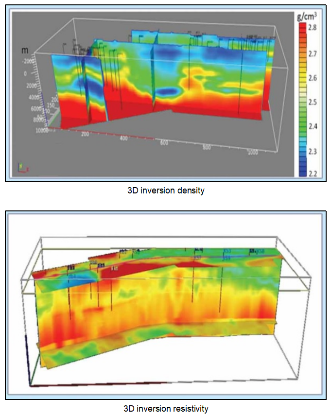
3D Gravity, Magnetic and Electromagnetic Surveys
3D Gravity, Magnetic & Electromagnetic (3D GME®) could gain more detail in complex structures (piedmont) and deep targets, to identify the lithological features and help to build a more reliable initial velocity model as a supplementary tool for seismic survey.
|
|
| |
|
|
| |
 |
|
| |
|
|
| |
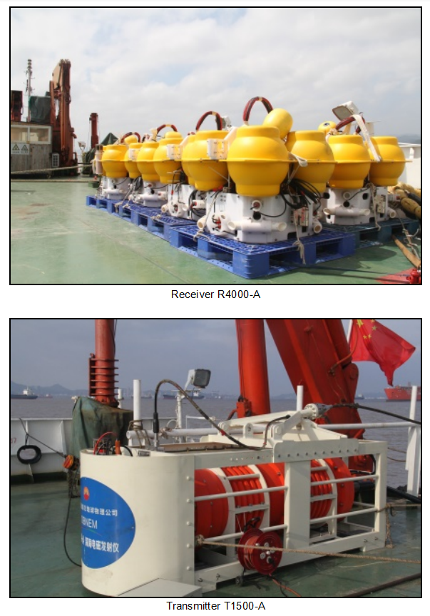
Marine Controlled Source Electromagnetic Surveys
Ocean bottom node electromagnetic (OBNEM) now plays a remarkable role in marine oil-gas exploration. We possess 2 sets of high-power transmitting systems, 40 sets of subsea electromagnetic receivers, and 1 set of monitoring system. With our self developed receiver and transmitter, we provide high quality marine CSEAM & MT service for offshore site design, operation, quality control, data processing and interpretation.
|
|
| |
|
|
| |
 |
|
| |
|
|
| |
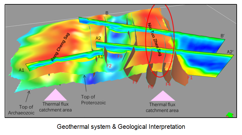
Geothermal & Underground Water Exploration
Taking full advantage of comprehensive exploration ability, BGP non-seismic has successfully conducted a lot of geothermal and underground water exploration projects by suitable method for different thermal targets.
|
|
| |
|
|
| |
 |
|
| |
|
|
| |
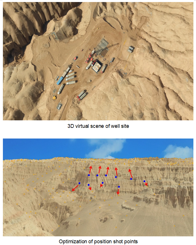
LiDAR (Light detection and ranging)
Light detection and ranging (LiDAR), especially airborne LiDAR, could obtain high accuracy, high resolution digital elevation data and images fast and cost-effectively, to help 3D seismic survey for scouting work area in 3D virtual scene, optimizing position of shot points and assessing HSE risks (to avoid cliffs, steep slopes and other dangerous areas prone to landslide and rockfall)
|
|
| |
|
|
| |
 |
|
|
|
| |
|
|
|