Service & products
|
|
|
|
|
| |
| |
KLSeis Seismic Acquisition Software System
BGP is strongly committed to geophysical method research and software development and integrates all leading technologies to produce its new powerful seismic data acquisition software system.
As a leading seismic acquisition software system, KLSeis provides the users with full data acquisition services. It is characterized with openness, high performance and cross platform, comprising 5 main categories of applications, namely Design, Modeling, Data QC, Vibroseis and Statics.
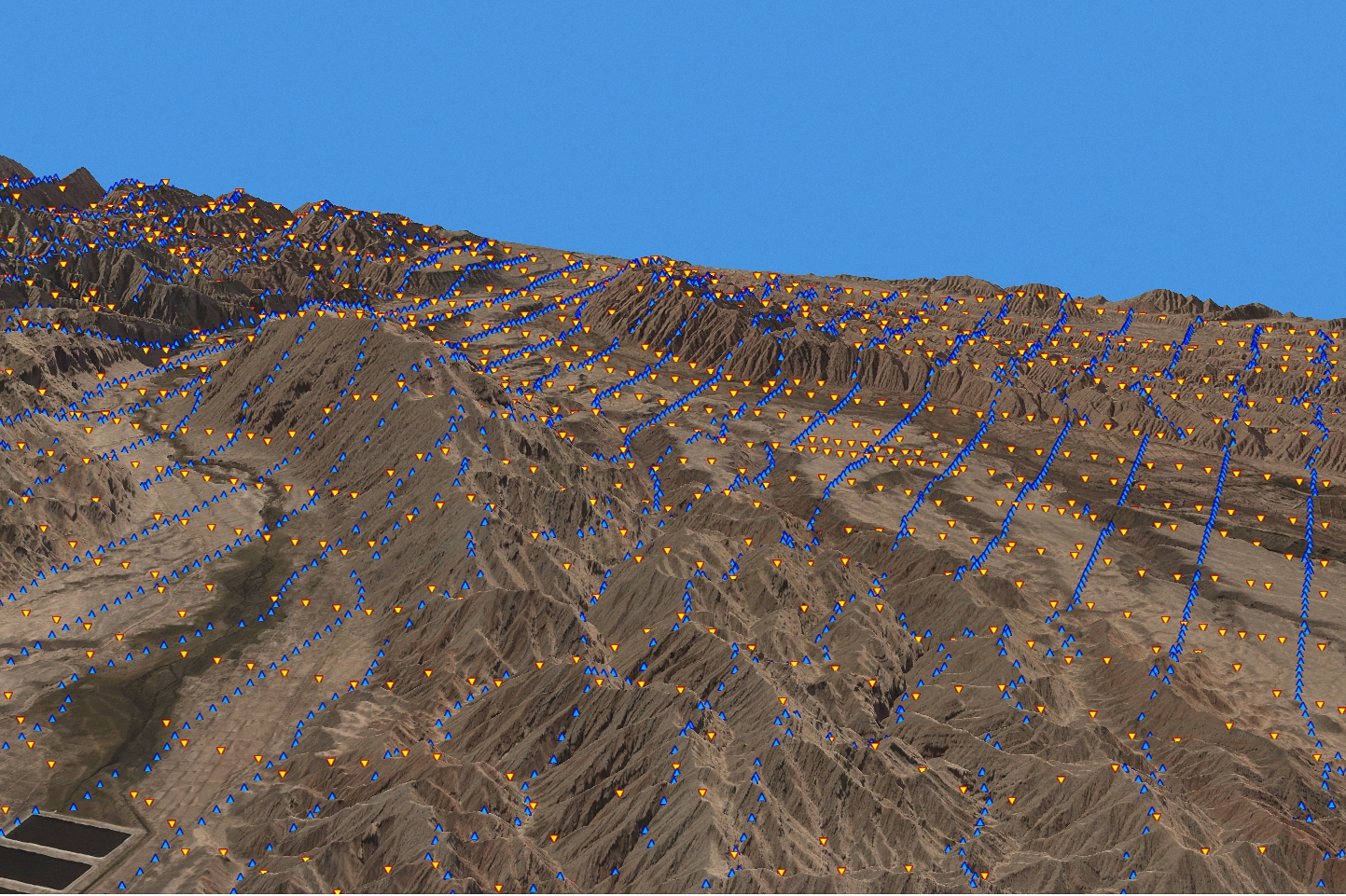
• Optimal geometry design in complex terrains for high-resolution oil & gas.
• Exploration.
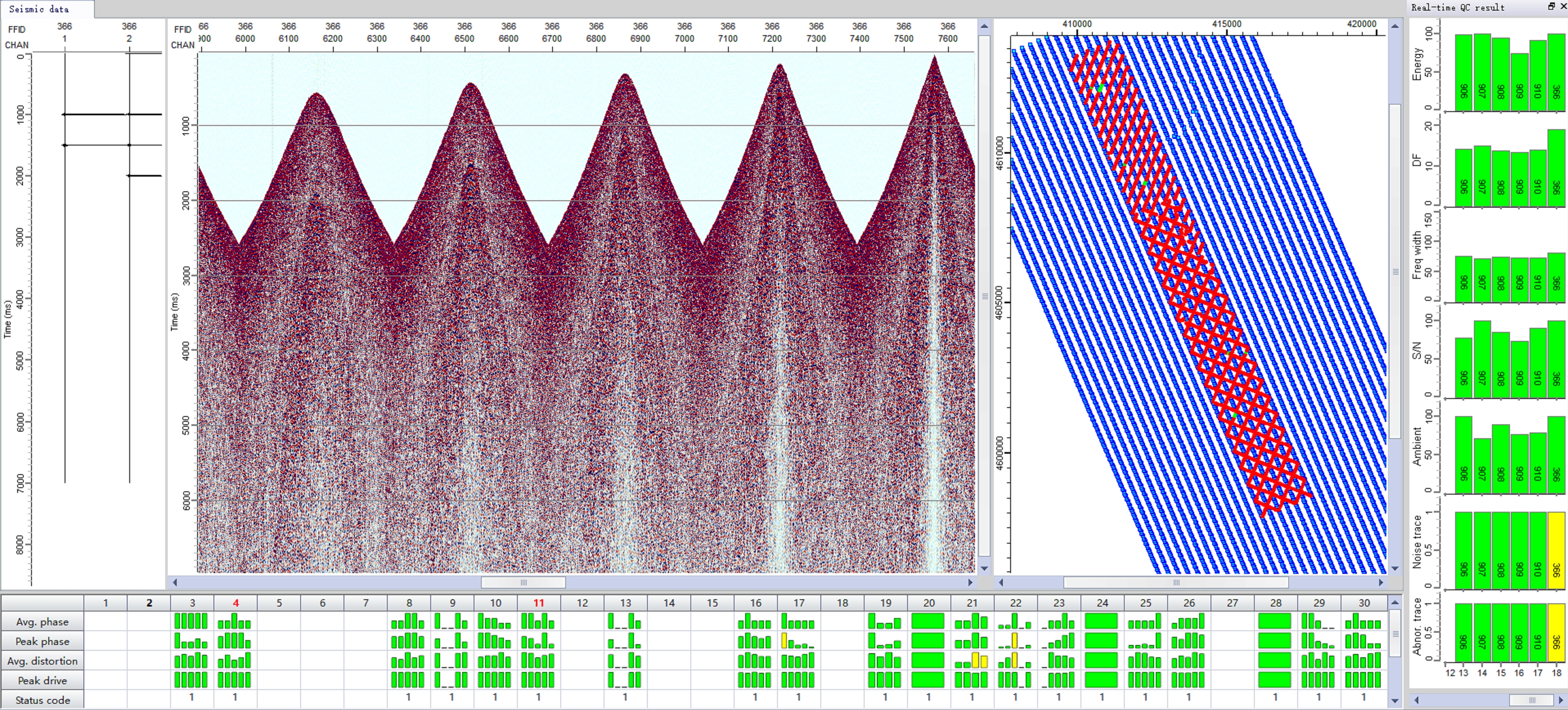
• Real-time equipment QC and monitoring to ensure data quality.
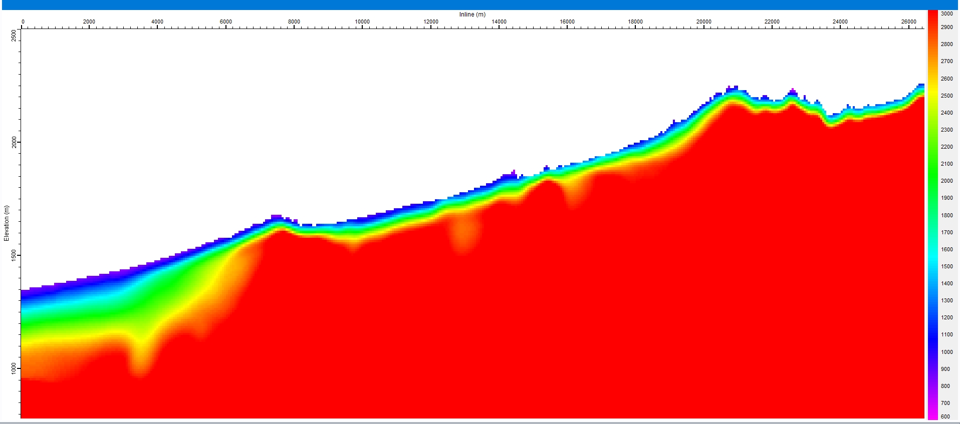
• Near-surface solution improving PSTM & PSDM imaging.
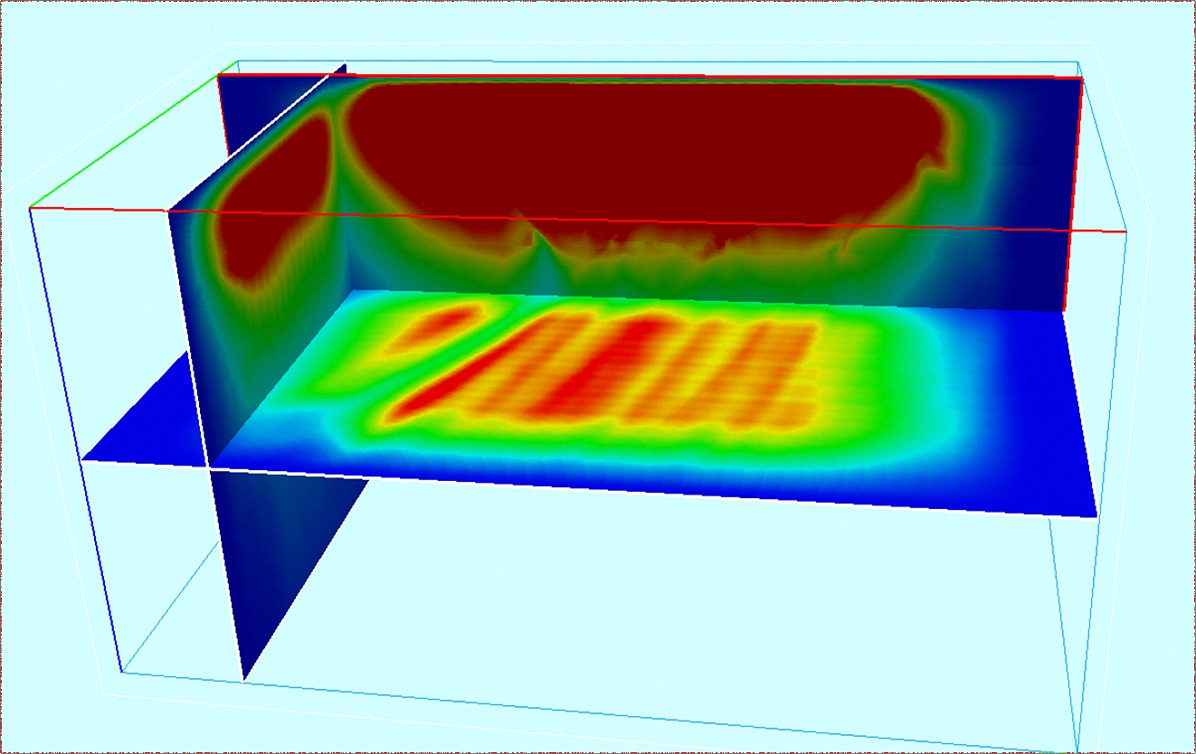
• Complex geological model building and forward modeling & illumination.
• Hybrid & UHP are fully supported.
|
|
| |
|
|
| |
Design
|
|
| |
|
|
| |
Modeling
|
|
| |
|
|
| |
Statics
|
|
| |
|
|
| |
Data QC
|
|
| |
|
|
| |
Vibroseis |
|
| |
GeoEast
GeoEast® provides a unified data platform, a unified display platform and a unified development platform. It supports data sharing, visualized interaction and a collaborative mode for processing and interpretation. With the flexible, modular and scalable architecture, GeoEast® can be customized to a workstation or a PC-Cluster version to meet the needs of on-site processing and large processing centers.
|
|
| |
|
|
| |
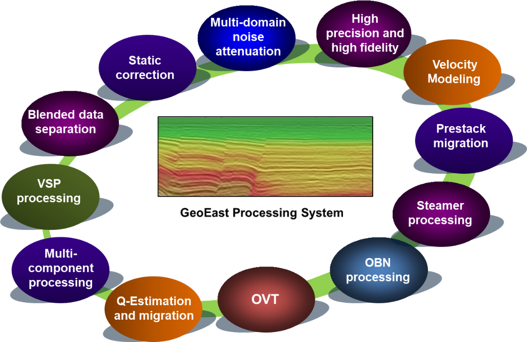
GeoEast Processing System
GeoEast has twelve technical series such as static correction, pre-stack denoising, velocity modeling, pre-stack imaging, etc. It has advantages in noise suppression, pre-stack imaging, multi-component processing, can provide a whole processing solution from pre-processing to TTI PSDM for complex surface/complex structure and low signal-to-noise ratio seismic data. GeoEast has the ability of efficient management of PB-level data and resource dispatching of clusters with thousands of nodes. The system operates conveniently and has strong user-friendliness, and can provide the complete processing solutions for various seismic data from land to marine, from P-wave to converted wave, from conventional acquisition to high efficient acquisition, and from surface to well.
|
|
| |
|
|
| |
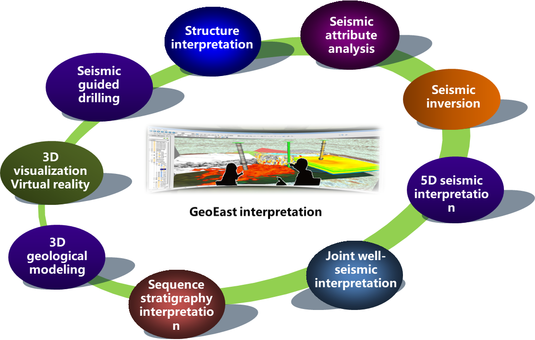
GeoEast Seismic Interpretation System
GeoEast Interpretation System is a fully integrated geophysical-geological system that equipped with structure interpretation, reservoir characterization, hydrocarbon detection, fracture prediction, joint well-seismic interpretation, 3D visualization and virtual reality. It provides comprehensive capabilities of multi-survey joint 2D and 3D seismic interpretation not only in time but also in depth domain, with specific techniques in efficient structure interpretation, attribute analysis, 5D interpretation, etc.
GeoEast V4.0 Interpretation System is based on iEco platform. The main console and data IO are newly developed, realizing the automatic conversion of coordinate system and virtual survey. The supporting functions of basin level multi-survey joint 2D and 3D seismic interpretation are optimized to further improve the basin level seismic interpretation. The subsystem of seismic attribute analysis and seismic inversion is reconstructed, and the supporting functions of basin level joint well-seismic interpretation are optimized, which enables further extension to the field of development.
|
|
| |
|
|
| |
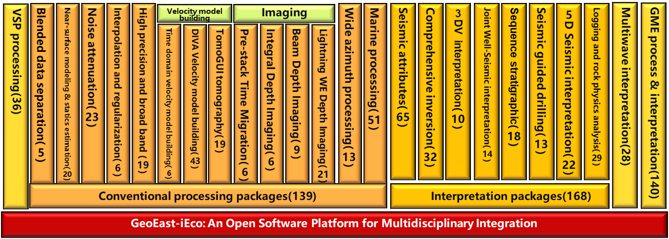
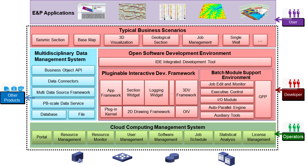
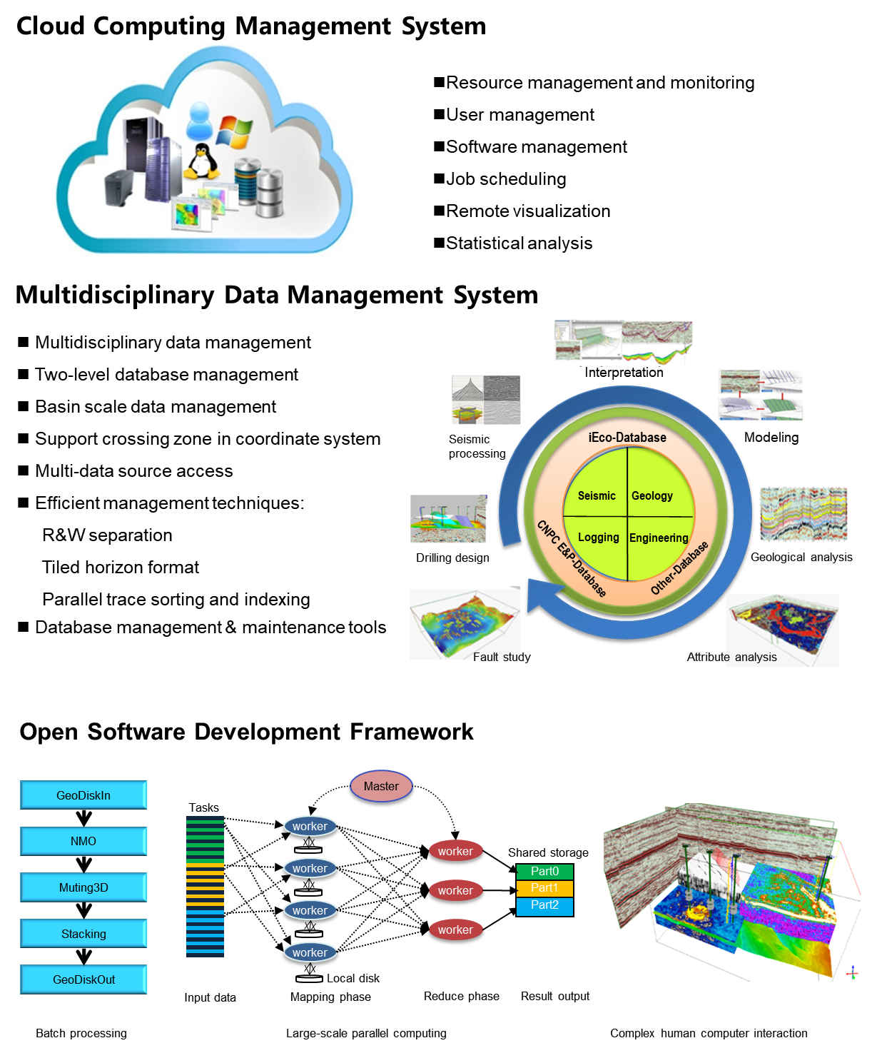
GeoEast-iEco : An Open Software Platform for E&P Applications
Enable construction of E&P software ecosystem
Three components: a cloud computing management system, a multidisciplinary data management system and an open software development framework
|
|
| |
|
|
| |
Enable Construction of E&P Software Ecosystem
|
|
| |
|
|
|
|
|
| |
|
|
|
|
| |
|
|
|